


To the Vent
I went back to Hell's Half Acre this morning, and this time I actually made it to the vent, aka the end of the trail. How did I manage this and still get back to IF before my sword lesson? Simple. I got up at 4:00 am and was on the road by 4:45 am and made it to the trail at 5:45 am. As it turns out, you wouldn't want to get up there much earlier than that (stop groaning you morning haters) as the sky was just getting light as I got there. Twenty minutes earlier and it would have been too dark to try.
I sort of expected to have the roads mostly to myself... I didn't. The interstate wasn't very crowded. More cars than I expected, but reasonable. Highway 20 out of IF was packed. I could see tail-lights from a dozen cars in front of me, and there were probably more beyond those. I decided they were probably commuting, but it took a while for that to make sense. My train of thought ran something like: "This road only goes to Arco...why would people live in IF and commute to Arco?" Then it dawned on me: INL, formerly known as INEEL, formerly known as INEL, commonly called "The Site." I had even passed an INL bus on the interstate. So that mystery was solved.
At any rate, I made it to the two-mile marker by 7:15 am, and picked that as a good spot to eat breakfast. I was at the four-mile marker around 8:40 am...and discovered that was not the end of the trail: it continues for another half-mile. This was mildly problematic since my ideal turn-around time was 8:45, but I decided I'd come this far, so I might as well keep going. It was about 9:00 when I got to the vent. It wasn't what I was expecting (pictures below). It was a very, very large, round depression of lava, rather like a caldera, but with a solid rock floor. I wish I'd had time enough to explore it a bit, but I was already slightly behind schedule.
On the way back, I saw my first wild rattlesnake. I was walking up one of the many lava-domes and had just gotten to the top. Movement caught my attention. The movement resolved into "Snake," which led to the thought, "Rattlesnake?" Then the snake rattled at me. I wasn't very close to it; I'd probably just surprised it. I got a good enough look at it to see the classic pit-viper head. For a moment, I thought it was moving towards me, so I took a few steps backward, but it had only been heading into one of the many cracks in the dome, still rattling. I gave the spot where I'd last seen it a wide berth and continued on my way. The rattling continued even after I was past. I was getting tired at that point, but the adrenaline rush from the seeing Idaho's one venomous snake helped. Somewhat. It also made me jumpy. I didn't really want to encounter a rattler on any of the trickier bits of terrain. Anyway, based on geography, I figure it was probably a Great Basin Rattlesnake (which is a subspecies of the Western Rattlesnake). Here is a page with info about Idaho's rattlesnakes. I'll probably add the main page to my Links list sometime soon.
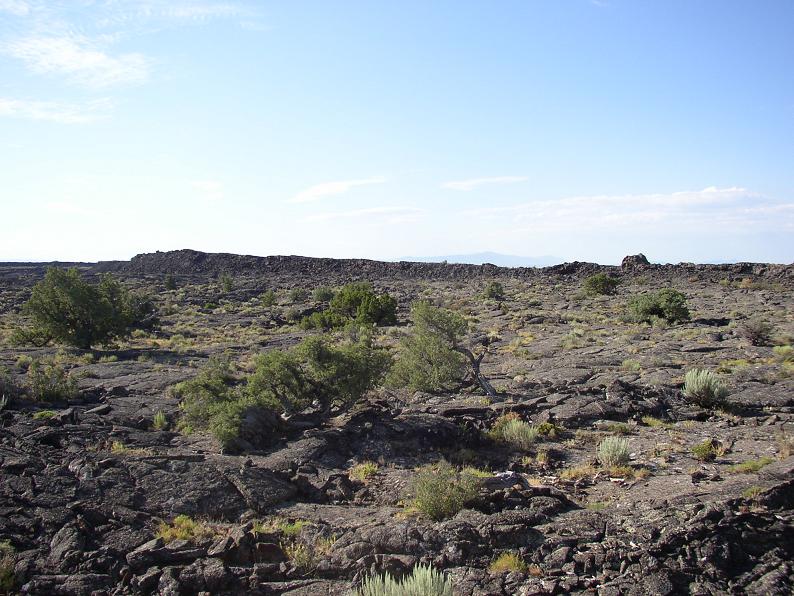
Some notes for anyone considering this hike. The terrain gets a lot rougher after the 3-mile marker. On the way back, I found smoother paths, but only because I was watching for them carefully. There are several fields of a'a that you just have to clamber across. No easy way around. I'm half-convinced that the name "a'a" came from some Hawaiian group trekking across lava. "Ah-ah! I ain't goin' that way!" Pahoehoe doesn't work quite so well, unless it's their equivalent of 'Oooh.' "Oooh (oe-oe)! This is nice and smooth for walking!" Anyway, it took me an hour and a half to get from the 3 mile marker to the vent, and an hour and a half back. So 1.5 miles in 1.5 hours. About half as fast as I could go on the rest of it. Up to the 3-mile marker, there's nothing too bad. The worst bit is right after the turn-off from the loop trail. There's some rather large a'a to traverse.
Okay, enough talk. Time for a few pictures.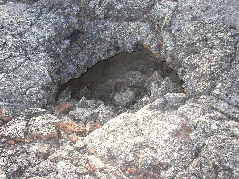 One of many caves I encountered.
 This is past the 3-mile marker. I was just impressed at the sheer size of the slabs, here. You can also see some substantial pahoehoe in the foreground.
 I'm not entirely sure, but it definitely looked like some of the lichen in this cave was phosphorescent. It also looked like there was a metallic insert in the rock. At any rate, some of the lichen has the color that all the original "glow-in-the-dark" products had.
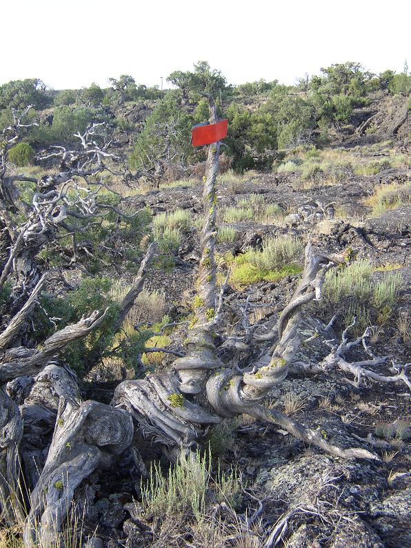 Here we have a guide-flag attached to a dead juniper. A quite striking dead juniper at that. No guideposts prior to the 3-mile marker are made this way.
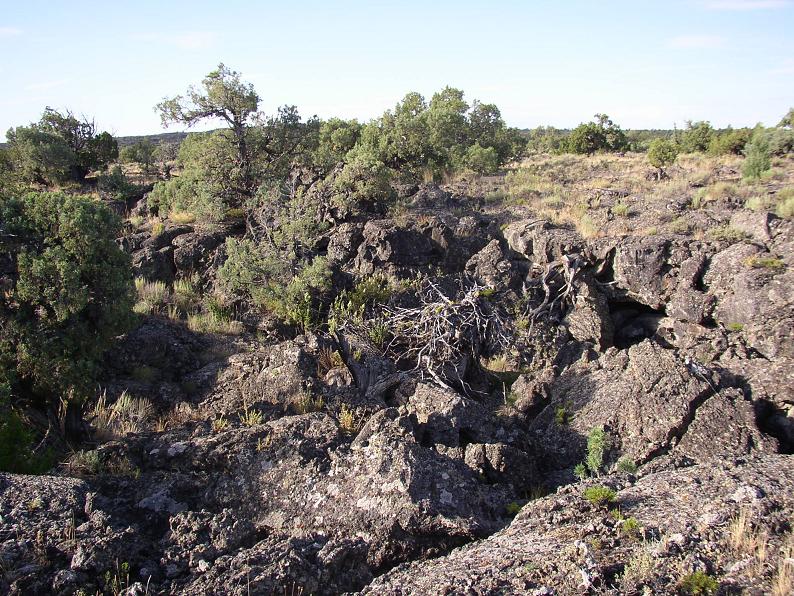 *sighs* A'a. Sometimes there's an easy path through it, sometimes not. When the pieces aren't too big, it's not bad anyway. But large a'a'... *sighs again*
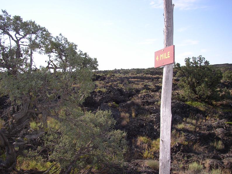 The 4-mile marker! It was mildly frustrating to see three more guideposts beyond it...
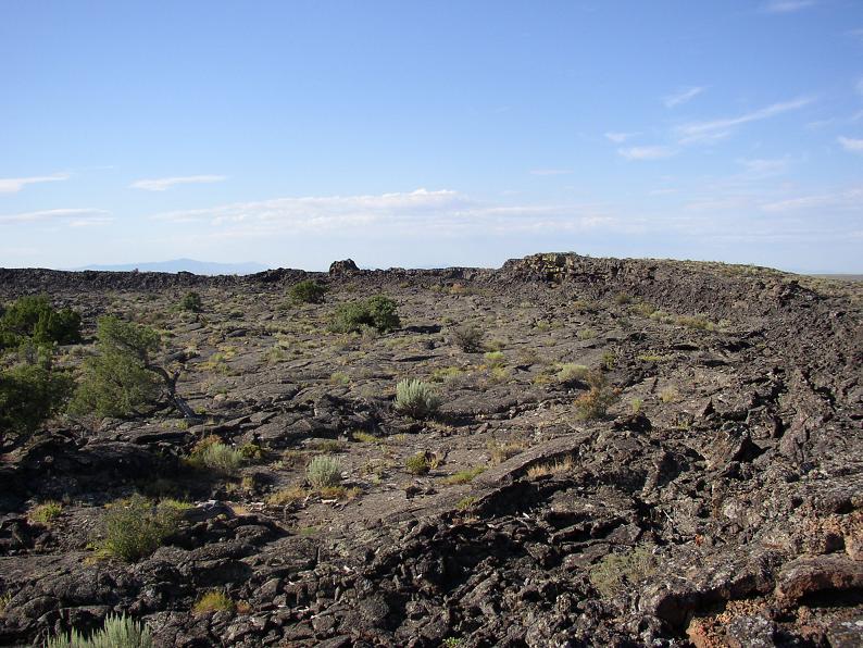
 And these last two shots are of the vent itself. You can probably best see the circular arc of the western edge in the top one. The bottom one is a view straight across. I would expect it to take at least 15 minutes to get across there. more if the terrain roughens up further in.
No comments:
Post a Comment