28 July 2006

Back in Fort Collins

The drive yesterday was fairly uneventful. We did see quite a few antelope, and some elk, along the highway(s). Also some Texans trying to get themselves killed by going 90 on a two-lane highway and trying to pass when there just wasn't room. We got into Fort Collins around 17:45. Naturally, we ate at Sri Thai. I had the Pad prig king pow (something like that), which is basically meat, carrots, onions, bell peppers all in a roasted chili sauce. I asked for it Thai hot. The Thai tea float was quite invigorating after the long drive.

Then we went to Barnes and Noble. I got a Tibetan chant CD and a Kitaro 2-CD set. I've gotten interested in Tibetan chant lately, and Don gave me a copy of one of his Kitaro CD's (so I must, of course, provide him with a copy of these). I also found a potentially useful book, Weeds of the West. However, when I looked at the price, I decided it might be cheaper on Amazon. It was. So that's a likely-to-order item. If nothing else, the book has a lot more thistles in it than any of my other books. *grins*

We also went to Target, in search of a hammer and a map of Denver. Hammer was easily located once I realized that "automotive" also included "tools." The map...was in with books, where I expected, but was on a row with computer programs, which we had ignored. But we finally found a good paper map. Barnes and Noble had several "quick-finder" maps, which are laminated, and never include the whole metropolitan area. Mom almost got one of those until I warned her about that. B&N also had several atlas-style Denver maps, none of which were user friendly. "Go to map ###" is not useful, when the map-numbering makes no sense to begin with. "Continued on page ###" is several orders of magnitude easier to work with.

Today? Well, I need to get to camp between 14:00 and 17:00 to check in and set up my tent. I would like to stop at Wild Oats and get some more Montina flour. I would also like to pop in at the Nepal Tibet import store, though that's less of a priority. We'll almost certainly eat lunch at Sri Thai again, though. :^D

Inquire Further

26 July 2006

Baking Notes

(This post is mostly so I know what I did on my most recent batch of yeast bread.)

Starting from Bette Hagman's Featherlight Rice Bread, I used

3 cups flour total:
1 1/3 c featherlight flour mix (Bette Hagman's)
2/3 c Montina flour
2/3 c hazelnut flour
1/3 c sorghum flour
Add 1/2 c goat's milk (heated to 160 F) in place of some of the water

Plus I made my usual changes: rice protein isolate instead of dry milk powder; 2 T lemon juice instead of the vinegar; upped the honey; 1 T yeast; olive oil instead of margarine.

If anyone's still reading, I love the flavor of the Montina flour, but it does seem to be drier than other GF flours I've worked with. Last time I just upped the honey, but it wasn't enough. Milk always tends to make baked goods moister. I'm hoping the hazelnut flour will add some moisture, but I haven't really played with it yet.

Further notes: the "medium loaf" instructions seem to result in about 4 1/2 c dough. This divides well into five small bread pans with slightly less than a cup in each. 9/10 c to be precise, but it's easier to measure out one cup and remove about a tablespoon.

At any rate, they seem to be rising all right. I won't know for sure how I did until they're done baking. Luckily I've started early enough that I can redo it should they be horrid. :^) Why bake five small loaves instead of one larger? Several reasons: (1) Easier to cut; (2) Easier to find places for them in the cooler, esp. places up high out of the water; (3) Cutting one doesn't mean exposing ALL of them; (4) Avoids putting all the eggs in one basket. ;^) Also, they seem to taste better in smaller loaves. It's probably my imagination, but so be it.

RESULTS: Awesome taste and texture fresh out of the oven. The one I cut was a tad doughey, so I put them back in the oven (foil-wrapped and at a lower temperature) for a bit. But they do seem much moister than my last effort. The question is, how well will that moisture last? The recook seems to have been enough to get out the dougheyness (doughiness?). So bread is go.

Inquire Further

My kind of Hummer

That research trail was too overgrown for me to make it very far. It branches off from the main trail just before the big bridge over the stream, and must not get very much use. If I try it again, I will remember to wear jeans, as much of the overgrowth is of the scratchy, thistle variety. But it wasn't a total wash-out. Some really interesting rocks, and... *grins maniacally*

HUMMINGBIRDS!


The left picture is reduced, 30% of full size. The picture on the right is a full size crop from the first (blogger may have shrunk it just a bit). Have I mentioned how much I like my new camera? *grins* Anyway, my Rocky Mountain bird book lists four species of hummingbird. This one looks most like a female Calliope Hummingbird, Stellula calliope. There was another very similar hummingbird flitting around it: a sleeker-looking female (my one picture of her didn't quite focus). What I'm thinking is that the one above is a recent fledge, based on her fluffiness and on the fact that she mostly perched on a branch and didn't fly too much. The other one seemed impatient, and kept flying around, chirping at the non-flying one occasionally. Impatient mother, perhaps? :^D That's all speculation, but it fits.

Inquire Further

25 July 2006

Scout Mountain Butterfly, Take II


Yay! It loaded this time! This morning, blogger's picture-loader would sit and sit and sit...and usually return a blank, useless, screen. Anyway, this is the promised butterfly from Scout Mountain. It's definitely a sulphur of some sort, and looks a lot like this picture of a female orange sulphur. Despite the name, the pictured female is clearly green, while the male is yellow. *shrugs* Even weirder, the picture is described as being of the "white" form. So...I don't get it.

Inquire Further

Rambling

I was going to post a butterfly picture from Scout Mountain, but Blogger's picture uploader is not being cooperative, so that will wait.

*sighs* I would have liked to have gone and hiked up to Independence Lakes today (near Burley), but I've got a few too many things to do. So those will wait until I get back from camp. What must I do? Well, get the front two rooms cleaned and rearranged, bake anything besides yeast bread that I want to take (yeast bread will wait until tomorrow), take my mom's vacuum to be looked at (or else look at it myself; I'm reasonably certain it's just the belt--Nope. Not the belt. Something's not getting power to the driveshaft that turns the belt), laundry, pack, and put all my plants where my aunt can find them. I'll try to give them a big, thorough drink before I go anyway, but I'll be gone long enough that they may need more.

I took a chest of drawers that I remember always being in the entryway when Grandma and Grandad were still in Akron. Mom didn't want it. Why? Because the drawers weren't on runners. *shrugs* They still open just fine, and it holds a LOT of stuff. It's already made my office about a thousand times more organized (and given me a bunch of empty containers to get rid of). My home office no longer looks like a junk room with a desk stuck in one corner.

And I found someone to take my old, too-big air conditioner. We gave it to my Aunt Sandra and her family. They've got some sort of cooler hooked to the window in one room (which currently is storing furniture for two or three other rooms that they're working on), but it doesn't get to the whole house. They have a much larger house than I do. :^) With my smaller window AC set at 76, the office tends to stay around 78, and the room furthest from the AC may get up to 84. When it's over 100 outside, 84 is just fine.

I guess that's enough for now. If I get enough done today, I might try a side trail at Gibson Jack that goes into some sort of "nature research area." We shall see.

Inquire Further

22 July 2006

Pre-Preparations

This morning was my last taiji lesson before taiji camp, which starts next Friday evening. I've actually been getting some impressive compliments from Don. On Wednesday he actually told me he thought I had the sword form down about as well as he did. I very much doubt that, as he keeps pointing out principles that I either don't understand or can't apply. :^) Ah well. We shall see what Bataan and crew have to say about my sword form. As far as the bare-hand form goes, I must be doing something right, because Don keeps showing me more advanced push-hands ideas. Some of which I can apply, some of which I vaguely understand, and some of which make no sense at all to me yet.

But I finally remembered to get hotel reservations made this afternoon. I meant to get it done last week sometime, and just kept forgetting about it. So we might have gotten a better spot in Fort Collins had I made them in a more timely fashion, but the place looks ok. I'll be there one night, the day before camp, my mom will be there the next night. Then she's going wandering while I'm at camp, mostly visiting old college roommates from the sound of it. I am very much looking forward to camp. It was an awesome experience last year, and I expect it will be so again. I'm not sure what kind of shape my legs are in at this point. I seem to have dropped to a lower stance, but I've been doing more hiking than practicing, honestly. The hiking helps part of the quads, but not as evenly as the taiji does. So my legs may well be screaming at the end of camp.

After camp, we're planning to go to Rocky Mountain National Park for a day or so. Which means I must do research and find new and bizarre places to stop along the way! *grins* We've been there several times, but I'm sure there's stuff we haven't seen yet. It is my solemn duty to make sure we DO see it. Though I'm sure we'll stop at the gift store up on Trail Ridge Road. Some nice stuff in the store, but I really like the short hike behind it. You climb up a rock/dirt staircase (likely built to control erosion from so many visitors), and go down the trail a ways, and there's an elevations sign. I can't remember the exact number, but it's over 10,000 feet. There's often still snow in the area, even this late in the summer.

I'm not sure what route we're taking home, but since Mom wants to stop off in Steamboat Springs, we just might go through Dinosaur National Monument. Another place to find, er, places we haven't visited yet.

We're not leaving until Thursday, but I may or may not have any time to hike in the meantime. We shall see.

Inquire Further

21 July 2006

Scouting for Flowers


*grins* These are just cool. They're called Monkshood (Aconitum columbianum), though they look more like smurf's hats to me. Don't be fooled, though. They're deadly poisonous. And the leaves DO look somewhat like geranium leaves. Geraniums are often gathered for medicinal purposes; there's a warning only to gather them while they're in bloom, because of similarity to this plant. Oh, and their scientific name, Aconite, means "wolf's bane" in Greek. The plant was sometimes used to poison meat in wolf-traps.


By contrast, this one is edible. It was growing in the beaver pond along the trail. Arum-leaved Arrowhead, Sagittaria cuneata. At least, the roots and tubers are edible, and are supposed to taste something like sweet potatoes when cooked (they're also becoming rare due to overgrazing; cattle like to dig them out of the water).


This could be Blue lettuce, Lactuca tatarica, or it could be Chicory, Cichorum intybus. Chicory's petals are a bit wider, so I think it's probably Chicory. Hmmm... looks like they're easier to tell apart once they've fruited.


Okay, this one is past flowering, but I'm just happy that I finally figured out what it was. It's serviceberry, aka saskatoon, aka Amelanchier alnafolia. This is probably the same plant that I thought might be a blueberry up the road to Chinese Peak. Anyway, the berries are edible, but I'd advise spitting out the seeds. They're known to contain compounds similar to cyanide. Cooking will destroy the toxins, though. [Edible & Medicinal Plants of the RM] I've eaten a few of these. They taste something like blueberries, but...not as strong a flavor.

Inquire Further

Raven


Then this ebony bird beguiling my sad fancy into smiling,
By the grave and stern decorum of the countenance it wore,
"Though thy crest be shorn and shaven, thou," I said, "art sure no craven,
Ghastly grim and ancient Raven wandering from the Nightly shore,—
Tell me what thy lordly name is on the Night's Plutonian shore!"

Quoth the Raven, "Nevermore."

—Edgar Allan Poe

Inquire Further

20 July 2006

Scout Mountain

This morning, I wasn't feeling well, so I figured I'd go up to Scout Mountain and just walk around the "Nature Trail." This is a short loop, a half-mile at most. I felt much, much better after the short walk, and decided that maybe I was up to going along the main trail (East Fork Mink Creek) for a while. Just a little ways. We-ellllll, I made it to the beaver pond (which is 2 miles, according to my trail book), and a ways past. I only stopped because there was a steep downhill stretch that I didn't want to climb down only to have to climb up again. Turns out that I was probably within a half-mile of where the trail meets the road that goes up to the peak. *shrugs* The really ironic thing is that on the drive out to Scout Mountain, I wasn't even sure I should be driving. My head felt weird. Much, much better now. The drive back in was no problem at all.

On the way up to the trailhead, I got stuck behind a small pickup carrying an oversized camper. The pickup might have been slightly larger than my dad's old Datsun, but that's not saying much. The camper was waaay too big for it. It was top heavy. Yes, any camper will do that to any pickup, but this was bad. Especially on a windy mountain road. About halfway up, the pickup pulled off at one of the viewpoints, so I had the road to myself the rest of the way up. I only encountered a few people on the trail. When I was almost back to the parking lot, there was a family with two or three kids. I mainly noticed the little girl, and hoped they weren't going very far. She had taken her shoes off, likely becase her flip-flops were worse than going barefoot. If they were going very far, then she's going to have very sore feet, whether she put her flip-flops back on or not.

At the moment I need a shower more than I need to sort through pictures (there were some new flower encounters), but I will post one of my favorites:

Inquire Further

19 July 2006

More Sodaferous Flowers

This is probably Scentless chamomile, Matricaria perforata. Real chamomile has a strong scent (PRM describes it as unpleasant). There's also a similar daisy, but as my picture is most similar to another Matricaria (The pineapple weed), I figure it's scentless chamomile.


And here is a brush, likely Common Rabbitbrush, Chrysothamnus nauseosus. There's a very similar brush, Green rabbitbrush, C. viscidiflorus. The difference is that it isn't as hairy as Common Rabbitbrush. *shrugs* I can't tell by the picture how hairy those leaves are; can you?


Oooh, this is Jacob's Ladder, Polonomium occidentale. This is NOT from my books. This from one of the links (fourth picture down) I recently added on the left. My books have some Jacob's Ladder varieties, but not this particular one.


NASFGRM identifies this one as White campion, Silene latifolia. This or something similar also grew on the island in Leavenworth.

Inquire Further

Soda Flowers

It seems that Soda Springs is far enough away to have several flowers entirely new to me...but there are still some very familiar ones. I'll stick to the familiar ones for now.

I'd be surprised if any Idaho residents haven't seen this along the road at some point. It's showy milkweed, Asclepias speciosa. It seems that milkweed contains poisonous alkaloids...but they are destroyed by cooking.


Here we have "scarlet gilia," aka skyrocket, aka Ipimopsis aggregata. Despite the name, it also comes in white, pink, and white with pink spots.


Note the interesting patterning on the bud that isn't fully out yet. This is either a Nodding thistle, Carduus nutans, or a Plumeless thistle, C. acanthoides. The difference is whether the flowerheads "nod" or stay upright. These seem to be upright, so I figure it's probably Plumeless thistle.


And this one is almost familiar. It's probably a variety of harebell. I just can't find one that grows with its flowers "all in a row" like this. No, I take that back. After looking up "raceme, n : usually elongate cluster of flowers along the main stem in which the flowers at the base open first," I figure this is common harebell, Campanula rotundifolia.

Inquire Further

18 July 2006

Soda Springs Shenanigans

I played tourist in Soda today. It was a spur of the moment decision reached last night around 21:00. I grabbed a bunch of travel brochures at a rest area on the way back from Layton and finally started looking through them last night. Several things in Soda caught my interest, especially "Formation Springs." It's a nature conservancy park with some interesting wildlife and geology, as well as mineral springs (which are largely responsible for the geology). Much of it was dry. I don't know if it's a case of the springs drying up or if it's just too late in the year. As large as some of the bushes are, I think some sections have been mostly dry for a while. They must get enough water to support the bushes, but it doesn't linger long enough to drown them. Anyway, there's a very large cave there, supposed to be a hundred feet or more long. If I had thought to bring, say, a flashlight, I might have been tempted to explore a bit. As it was, I didn't. So here's a picture of a much smaller cave:
From the looks of things, this "park" has not had any maintenance for quite a while, and it is not well-labelled from the road. If you come into Soda on Highway 30 from Lava Hot Springs, turn left at the light where it meets Highway 34 (there's a turn to stay on 34), then turn right at Trail Canyon Road, across from the phosphate plant. Then keep a sharp eye out for an itty-bitty sign on the left. It's not very far down Trail Canyon Road, but it's very easy to miss. Look for a long series of fences made from unpolished tree trunks. (And if you find yourself going through a narrow valley, you've gone too far. If you meet a fork in the road, you've really gone too far. Needless to say, I needlessly wandered some back roads this morning.)

The main trail going right from the parking lot is in good shape up until the stream crossings. Some side treks going in and among the caves and rocks are not in good shape, but it's well worth it to go down and take a closer look. After the first bridge, the trail becomes overgrown. I pushed through and got nice shots of some mineral pools back there, but I gave up when I got to a swampy region where the trail just vanished. Swampy trail, I might have gone on (depending on how swampy). Solid ground with no trail, I would have cast around trying to find it. As it was, I turned back. As I pushed my way back through the overgrown sections, I felt a sharp pain in my right hand. It was...Stinging Nettle!
The sensations were rather interesting. The actual encounter felt more or less like an injection. Then it started to tingle and hurt a bit. The pain made a half-hearted effort to spred through my hand, but didn't get far. There was a white bump at the site of contact, surrounded by red that also made a half-hearted effort to spread. I hadn't gone very far when the pain faded, almost to a dull itch. I was both disappointed and relieved. When I noticed the bump fading, I tried to get a picture of it. Do you have any idea how hard it is to take a picture of your own right hand? *sighs* None of them focused. So when I had another encounter with it, attempting to explore the trail that leads straight out from the parking lot, and it was with my left hand, my first thought was, "Cool. It should be easier to get a picture of the left hand." Then I realized what I had just thought and mentally slapped myself. At any rate, the one on the left hand was on a finger and didn't even get the bump or the redness.

From there, I went to Hooper Springs. For this one, there are obvious signposts. I think the road is called "Dam View" or something like that. There's "Dam" in the name, at any rate. It goes on the south side of the phosphate plant. Mostly, it seems to be a picnic area and playground. There's a pavilion built around the spring itself. Here's the view from inside:
This is probably a carbonated spring. The water contained a lot of bubbles, and Soda Springs gets its name from the carbonated springs in the area.

The last stop in Soda was the Geyser. If it has a name, other than "Soda Springs Geyser" or "Tame Geyser," I never saw it. It's not exactly a natural geyser. In 1937, someone was digging down, looking for a hot water source. The plan was to give Soda Springs some thermal pools much like those in Lava Hot Springs. Well, they found a water source, and it began spurting everywhere. There weren't too many other details, but I'm assuming they capped it off, then realized that the pressure build-up would eventually make it burst. So they put a timed release valve on it. Voila! A geyser that would really go off every hour, on the hour. They hoped it would be a huge tourist draw. It wasn't. A little kid summed it up to his dad and brother as I was leaving. He said, "Manmade," in a rather disgusted tone of voice. Of course, he also thought the orange coloration in the rocks was manmade. His father began trying to explain about minerals in the water making the rocks turn colors. :^D At any rate, here's a shot of the geyser going off:


And here are a rather amusing warning sign and the run-off channel for the geyser:


Before heading back to Pocatello, I drove north on Highway 34, looking for Gray's Lake Wildlife Preserve. Mostly, it seems to be protected marshes and grassland. I didn't see too much wildlife. Some swallows, possibly a prairie dog (or else a very fat ground squirrel)...then at the far end, there was a vulture perched on a fencepost, surrounded by a parliament of about 12 ravens. Presumably there was carrion nearby. There didn't seem to be much encouragement of wildlife viewing, as there were no easy stop-off points until you turned on West Side Road to get back to the highway. *shrugs*

Inquire Further

17 July 2006

Cooling Off

Well, it's that time of year. The time when I give up on toughing out the heat and put a window air conditioner in the living room. This year I got a new one. There was nothing mechanically wrong with the old, except that it was too large for me to move by myself. It wasn't the weight. It was the size. I could not get a solid grip on the opposite side to carry it. This was not a problem when I still had a roommate, but, at the moment... It's much more practical for me to have one I can move by myself. Also, this one doesn't require any outside support pieces.

Anyway, one last set of flowers and I'll be caught up. These are from West Mink Creek.

This is Mountain Hollyhock again, which turns out not to be a true hollyhock at all. :^D It's actually in the mallow family. Ah well. So Pam and I were both right.


This one looks like an orange dandelion, and, like dandelions, is in the aster family. Agoseris aurantiaca, or Orange Agoseris. Interestingly, the sap contains rubbery compounds.


Lastly, some berries that are NOT edible. Baneberry, Actaea rubra. In fact, the entire plant is poisonous, not just its berries. No reported North American fatalities, but according to PRM: "2 berries can cause severe cramps, headaches, vomiting, bloody diarrhea and/or dizziness. Severe poisoning results in paralysis of the respiratory system and cardiac arrest."

Inquire Further

From a Jeep Road up to Chinese peak

More catch-up flowers. :^D Not to be confused with the condiment as I muster up the photos and names.

At first, I thought this was just a small sagebrush in bloom. I was half-right. This is probably Silver Sagebrush, Artemisia cana. Except...FGRM says that Silver Sagebrush mainly grows east of the continental divide. So...it could be that. Might also be antelope brush. *shrugs*


This is quite pretty. It's also considered an invasive nuisance. Moth mullein, Verbascum blattaria. It's a European import that is still sometimes planted as an ornamental flower, but it spreads like mad. There were several areas up the road to Chinese Peak just filled with it. [One site suggested that people pull both this and common mullein whenever it is found...but I've never seen common mullein this...densely packed around here. It seems to have reached a balance with the native flora.]


This one isn't new...I just thought it was cool to have four bees all on the same flower. This is the thistle that I think is a variety of bull thistle, but I'm not completely certain. Definitely a thistle, either way.


Not a flower, but an...oddity. I turned up a side road (mainly because there was SHADE down it) and found the remnants of one or more drunken revels. I have no idea how, exactly, the broken tv remnants got up in the tree, but I imagine it went something like this:

"Dude, lookit. We can watch the game on this here tay-vay."
"You idjut. There ain't no 'lectricity up here!"
"Yeah? Wanna bet?"
"Just put it back in the truck."
"No!"
"Fine. I'll put it back."
Scuffle. CRASH!
"TV's broke, dude."
"Hey, if we put it up in the tree, we can still watch it!"

Inquire Further

Flowers from Hell's Half Acre

I didn't expect to find anything new at Hell's Half Acre this late in the summer, but there was one entirely new one, one that hadn't bloomed the last time I was there, and one that I've seen other places but never got around to identifying.


First, the new one. The flowers seem to be smaller versions of the probably carnation I found at City Creek (Pam agreed that it was a carnation, and even found a sketch of a carnation very like it in one of her botany books). So until I find out otherwise, I'm going to call this one "desert carnation."

This one I'm pretty sure is Hooker's Thistle, Cirsium hokkerianum. Oh, cool. It looks like our common native thistles are all edible. Listed in Edible & Medicinal Plants of the Rocky Mountains: Canadian thistle, Bull thistle, Hooker's thistle, and Leafy thistle (Elk thistle was mentioned in PRM as well). However, they taste better if you cook them well, and you have to be very careful with the spines, and remove them before eating. Probably best left as a survival food, since EMPRM also notes that some contain "potential" carcinogens. I'll assume that means substances similar to known carcinogens, but that haven't been specifically tested yet.


This one I have seen other places, notably on the ridgeline at Gibson Jack. I'm not completely certain, but I think it's some variety of a plant called "bedstraw." As the name suggests, it was once used to stuff mattresses. Northern bedstraw is Galium boreale, but this is more likely to be "Cleavers", or Galium aparine, based on the way the leaves are grouped. [Addendum: Maybe not... You can see several bedstraws here, and none of them look right. Maybe it's a weird variety of buckwheat?]

Inquire Further

16 July 2006

West Fork of Mink Creek

This morning I hiked up, well, read the title. It's another hike found by going out on the Old Bannock Highway. Strangely, I see more of the math department when I go hiking than I do when I stop to pick up my paycheck from my mailbox. This was a nice, gentle trail. Mostly shaded. It does climb steadily, but it's rarely very steep, and the shade is VERY nice this time of year. A few bugs, but it never got bad enough for me to try out any bug repellants. It was still quite green, which seems to be unusual for this time of year based on what I overheard Tracy Payne's group discussing. Of course, this is the first year in a LONG time that Idaho hasn't been listed among the severe drought states. We actually exceeded our water quota in most regions. Our neighbors to the south and east, however, are still in major drought.

Speaking of water, much of Pocatello's water comes from Mink Creek. There were occasional old cisterns along the trail. I think that the visible structures are all old and out of use. You can see a few of them below:


And a few more shots from the trek:

Here is West Mink Creek as seen near the "second" bridge. The first "bridge" is really just a series of corrugated pipes with dirt and rocks thrown over them.


Butterflies! They look like more Fritillaries, likely the Callippe Fritillary, Speyaeria callippe. And, yay, I'm getting the hang of taking close shots with my new camera.


A chipmunk who scampered across the trail but obligingly paused long enough for me to get his picture.


Gorgeous, shiny butterfly. No clue what kind it is. My (very) limited research suggests it may be in the Brushfoot family. I wouldn't recommend taking my word for it, though.


A strangely patterned leaf. I did not notice the ants on it while I was taking the picture. I suppose the patterning could be something done by the ants, or some other bug, or maybe even a fungus. *shrugs* The patterns are pretty, nonetheless.


Lastly, a currant bush full of ripe currants. Quite, quite tasty. I picked a few and ate them on the way up. My dad says he prefers black currants, because "At least you can tell when they're ripe." Which didn't make much sense to me. When the orange ones are ripe, the inner veining is easily visible through the skin.

Inquire Further

14 July 2006

New Toy + Another Blackrock Canyon

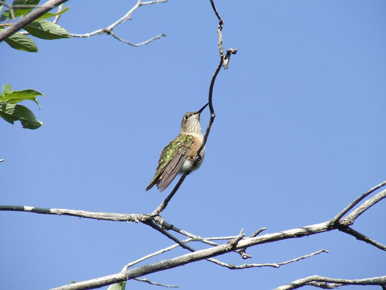
Yesterday was my birthday [Thank you to those of you who acknowledged it]. I actually had my birthday present from my mom about a week early, but figured I'd wait to post about it until the actual event. It's a camera. With a 12X optical zoom. My other camera is great for scenery and flowers, but for skittish wildlife, it's a joke. You have to get waaaay too close, which can be dangerous and is nearly always impractical. So I'd been wanting one with a high optical zoom for a long time. FYI, digital zoom is NOT the same thing. Digital zoom is essentially the same thing you can do on your computer: zoom in on an existing image. The further you zoom in on it, the worse it looks. Optical zoom actually uses lenses to get you a better image of an object far away. So I can now GET decent pictures of stuff that would be barely visible at best with the other camera.

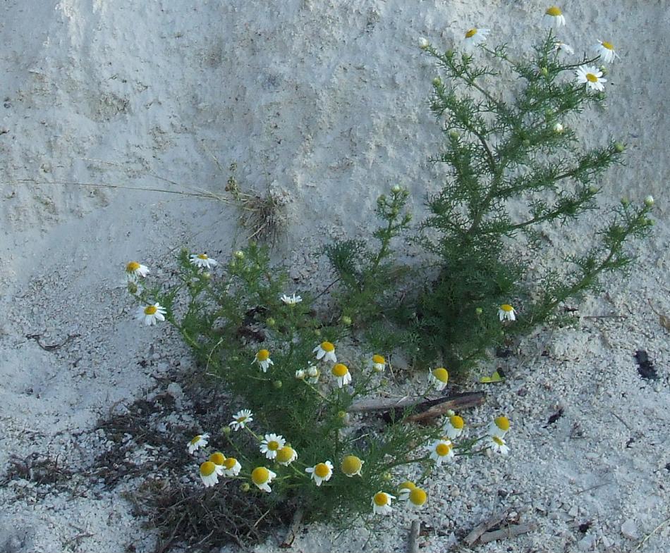
There is a trade-off, however. Basically, the old camera is near-sighted. The new one is far-sighted. With my old camera, I can get great flower shots from 6-12 inches away, occasionally closer. The new one won't focus on anything closer than six feet, unless you put it on "flower" mode [the button has a flower on it], and even then you can't zoom heavily on anything closer than six feet. The first day I tried it out, I was getting very frustrated with it, but I'm slowly getting the hang of taking decent pictures of flowers with it. It's really nice to be able to zoom in on something that I couldn't possibly get to (across a river; up a cliff; whatever) and actually see what kind of flower it is. It's just frustrating that I have to back up, and back up, and back up...if I want a picture of a flower right beside me on the path. Oh, and I DID get a few wildlife shots today. Nothing too exciting: birds and bugs, mostly. But I'm happy that you can SEE them, and tell what they are.

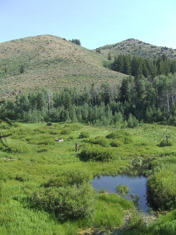
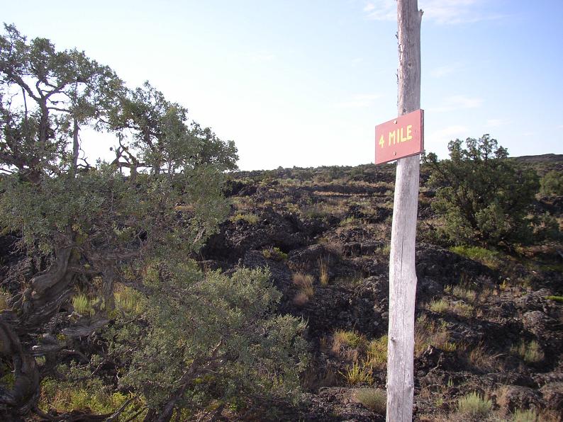
And the other Blackrock Canyon is between Pocatello and Inkom. It goes up towards the mountain formerly known as Chink's Peak (changed to Chinese Peak at the behest of a Japanese immigrant who found the name offensive; I found it a historical curiosity, since I've never encountered anyone who actually uses 'Chink' as a derogatory term for orientals). At any rate, I took the long way around. I'm sure there IS a shorter way to get there from where I was, but I didn't know where to turn. So I took a quite scenic and interesting route through the back hills between Pocatello and Inkom. Some very pretty country there, and a place where my mom might be able to acquire some cattails. I don't know why she wants them; just that she continually brings them up. Anyway, after I was thoroughly confused as to my location relative to the rest of Idaho, I consulted a map...and found that I might as well keep on the same road (but turn around) and go to Inkom, and then the place I wanted would be off Highway 91.

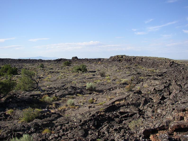
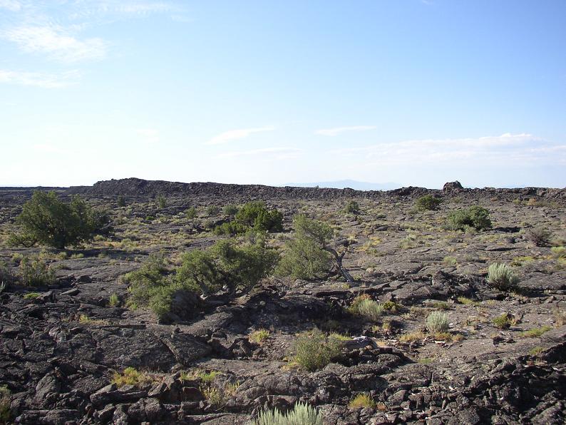
From the looks of things, the trail is mostly used by ATVs, though I encountered none today. I walked up it until it joined another ATV trail, and picked that as a good time to turn around. This is one that would be better earlier in the year, as it has very little shade. There are a few shady spots where some trees grow, but not many. Still, it was quite enjoyable. I might come back very early sometime and try it before the heat sets in.

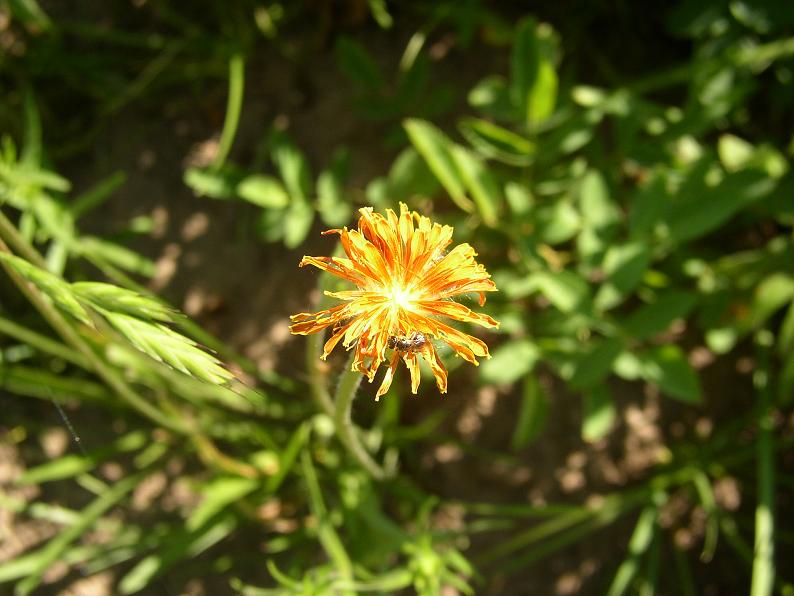
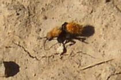
Two events of interest. Just as I was starting out, I saw an interesting...bug. At first I thought it was a strange spider, but I finally saw that there were, in fact, three body segments. The bug itself was interesting, but more interesting was when an ant attacked it. I suppose the ant thought it might be a good snack, but this fuzzy orange bug wasn't injured and fended itself off. It or the ant made a sort of buzzing/whistling noise. Very, very faint, but it stopped when the confrontation stopped. As far as I know, ants don't make noise, so I'll assume it was the orange bug, telling the ant off. Here's the orange bug (old camera):


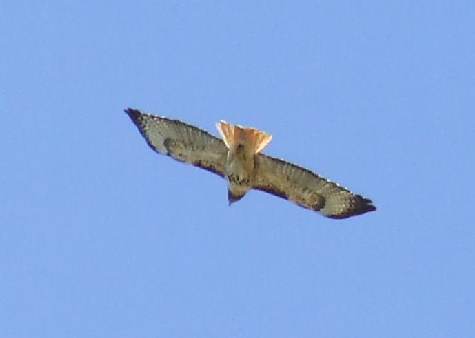
The other also involved a confrontation, but between a hawk and a vulture. *grins* I'd been hearing hawk cries (the sort of kree-ee-aahh), but when I'd looked up, I'd only seen the vulture. Finally I saw them both. At first, it looked like they were both just circling in the air, maybe even working together. Then the hawk divebombed the vulture. She kept doing this every time the wind currents brought her on a trajectory toward the vulture, and the vulture kept flapping to get out of her way. And I'm not sure why I think the hawk was female. Anyway, I just stopped where I was on the hillside and watched the show for a while, until they both disappeared over the next hill. It looked like maybe the vulture was following the hawk, hoping she'd lead him to a food source. *shrugs* Anyway, I didn't get the vulture, but I DID get a picture of the hawk (new camera; with the old, she would have been an itty bitty speck):

I did crop the image down, as she was surrounded by an awful lot of blue sky. :^D {Update: I'm reasonably certain this is a red-tailed hawk. The plumage can vary, but the call is quite distinctive.}

And I'll finish off with a few shots made possible by my new toy:
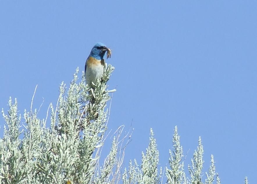
Bluebird. {UPDATE: Probably a Lazuli Bunting instead, Passerina amoena. They have more rounded bills and less red on their chests. I can't be certain without a shot of the wings, though. Lazuli bunting's have light stripes on their wings.} I couldn't tell that it was blue when I was taking the picture, though. All I could see was that the head was darker than the body.

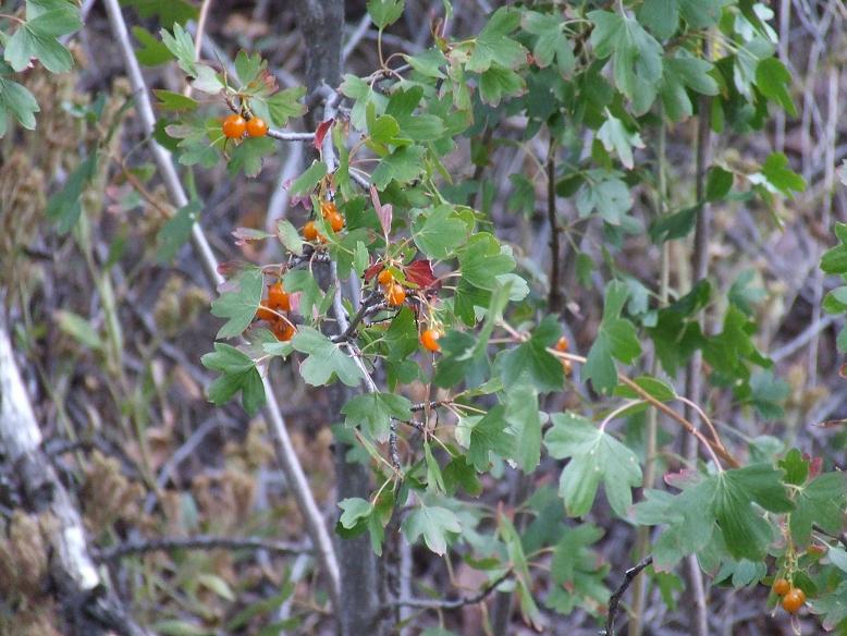
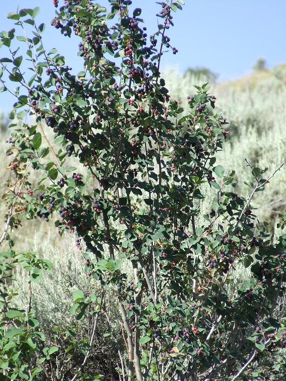
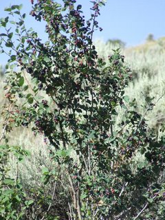
A bush full of berries on the hillside. It was far enough up and off the trail that I didn't want to climb to get a better look. With the close-up, though, I'm pretty sure this is a blueberry bush. (There were also currant bushes, with ripe currants, but I didn't take pictures of them)

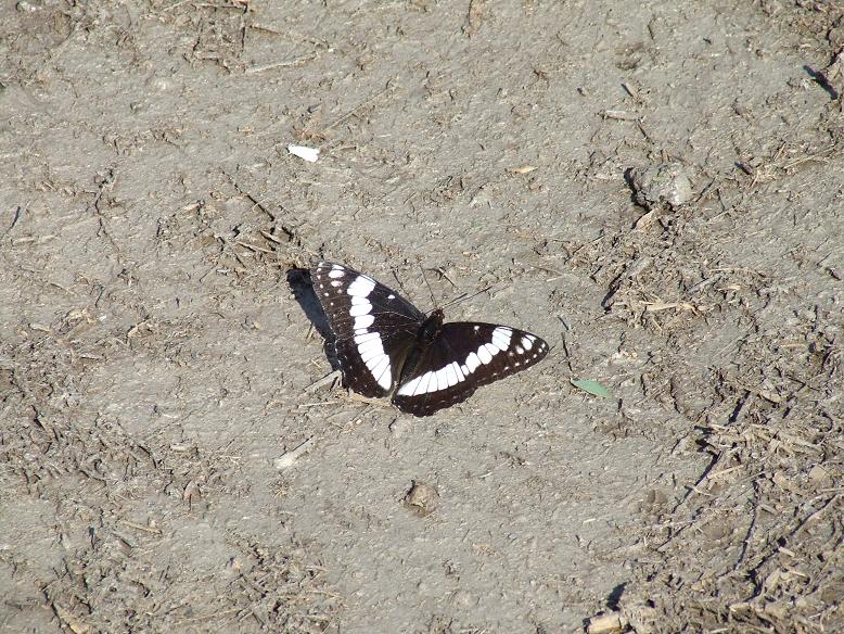
I've gotten pictures of similar butterflies before, but because this was all optical zoom, the detail is SO much better. You can almost see the scaling on the wings! And this one is Weidemeyer's Admiral, Limenitis weidemeyerii. I'd never seen these before this summer, but they seem to be pretty common in the hills around here. They feed on aspens, willows and cottonwoods.

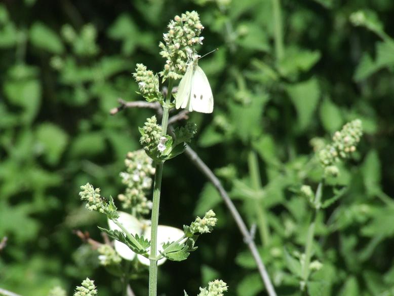
One nice feature of the new camera is a "rapidfire" mode, where it will continue to take pictures so long as you keep holding down the button. These little butterflies moved around so much that it was really the only way to get a decent picture of them. Not as distinctive as the Admiral above, but it's probably a Cabbage White, Pieris rapae. The two spots mean it's female (male has only one spot).

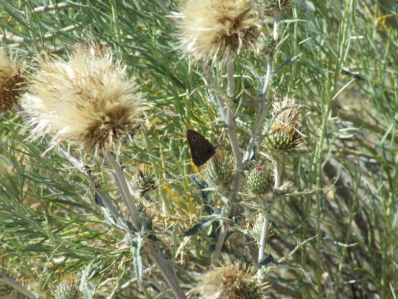
And this butterfly seems to be a Small Wood-Nymph, Cercyonis oetus. They feed on grasses, and are often abundant in sagebrush scrub.

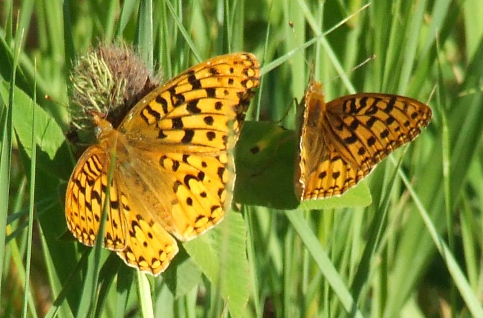
*sighs* This one didn't focus as well as the others. I needed to either take a step back or zoom out a bit. I think this is some sort of Fritillary. Closest match I've got is Hydaspe Fritillary, Speyeria hydaspe. The odd thing is that both Fritillaries prefer moist areas. There were a few mudholes in the road (late snow melt?), but otherwise it was quite dry.

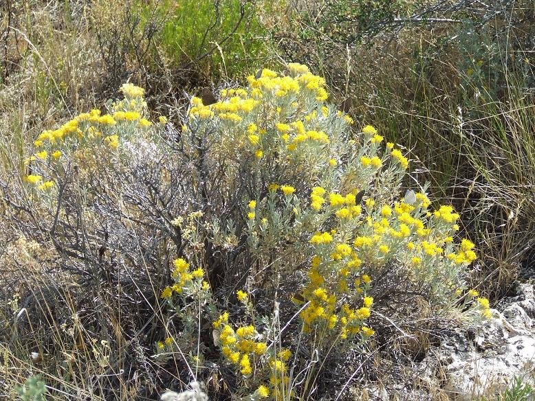
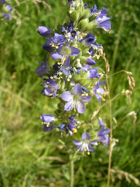
I do have a few new flowers to find, from this trip and from Hell's Half Acre, but those will wait a bit. I just wanted to show off what my new camera can do. Oh, and butterfly identifications are all from National Audobon Society: Field Guide to the Rocky Mountain States. It's my only book with butterflies in it.

Inquire Further

13 July 2006

Pirates, II

Highly recommended. It's...not quite as good as the original, but it comes close. I wasn't sure at the beginning, as ol' Jack Sparrow didn't quite seem to be himself, but that was soon (er, eventually) explained. Short version: There's a curse; again; this time about to come due on Jack's head. One thing I really liked were the homages to pirate films of days gone by. The classic sword-duel on the balcony, for instance. Also some nods to non-pirate films. Several scenes made me think Raiders of the Lost Ark.

One thing I like is the non-buddy nature of both this movie and the original. That is, you can't always count on the characters to stand up for each other. Okay, Will and Elizabeth are exceptions. But anyone else? *grins* When their interests coincide, sure. Otherwise, all bets are off. One thing did puzzle me, though... It was towards the end. I don't want to spoil too much, so I'll just ask a leading question: If you had in your poessession something that would kill the being to whom you owe your soul (more or less), would you (a) plan to bargain with the being or (b) take the opportunity to destory the being? Unless there's some reason that his death wouldn't negate the debt, I'd probably go with (b). It's a LOT safer.

Inquire Further

12 July 2006

To the Vent

I went back to Hell's Half Acre this morning, and this time I actually made it to the vent, aka the end of the trail. How did I manage this and still get back to IF before my sword lesson? Simple. I got up at 4:00 am and was on the road by 4:45 am and made it to the trail at 5:45 am. As it turns out, you wouldn't want to get up there much earlier than that (stop groaning you morning haters) as the sky was just getting light as I got there. Twenty minutes earlier and it would have been too dark to try.

I sort of expected to have the roads mostly to myself... I didn't. The interstate wasn't very crowded. More cars than I expected, but reasonable. Highway 20 out of IF was packed. I could see tail-lights from a dozen cars in front of me, and there were probably more beyond those. I decided they were probably commuting, but it took a while for that to make sense. My train of thought ran something like: "This road only goes to Arco...why would people live in IF and commute to Arco?" Then it dawned on me: INL, formerly known as INEEL, formerly known as INEL, commonly called "The Site." I had even passed an INL bus on the interstate. So that mystery was solved.

At any rate, I made it to the two-mile marker by 7:15 am, and picked that as a good spot to eat breakfast. I was at the four-mile marker around 8:40 am...and discovered that was not the end of the trail: it continues for another half-mile. This was mildly problematic since my ideal turn-around time was 8:45, but I decided I'd come this far, so I might as well keep going. It was about 9:00 when I got to the vent. It wasn't what I was expecting (pictures below). It was a very, very large, round depression of lava, rather like a caldera, but with a solid rock floor. I wish I'd had time enough to explore it a bit, but I was already slightly behind schedule.

On the way back, I saw my first wild rattlesnake. I was walking up one of the many lava-domes and had just gotten to the top. Movement caught my attention. The movement resolved into "Snake," which led to the thought, "Rattlesnake?" Then the snake rattled at me. I wasn't very close to it; I'd probably just surprised it. I got a good enough look at it to see the classic pit-viper head. For a moment, I thought it was moving towards me, so I took a few steps backward, but it had only been heading into one of the many cracks in the dome, still rattling. I gave the spot where I'd last seen it a wide berth and continued on my way. The rattling continued even after I was past. I was getting tired at that point, but the adrenaline rush from the seeing Idaho's one venomous snake helped. Somewhat. It also made me jumpy. I didn't really want to encounter a rattler on any of the trickier bits of terrain. Anyway, based on geography, I figure it was probably a Great Basin Rattlesnake (which is a subspecies of the Western Rattlesnake). Here is a page with info about Idaho's rattlesnakes. I'll probably add the main page to my Links list sometime soon.

Some notes for anyone considering this hike. The terrain gets a lot rougher after the 3-mile marker. On the way back, I found smoother paths, but only because I was watching for them carefully. There are several fields of a'a that you just have to clamber across. No easy way around. I'm half-convinced that the name "a'a" came from some Hawaiian group trekking across lava. "Ah-ah! I ain't goin' that way!" Pahoehoe doesn't work quite so well, unless it's their equivalent of 'Oooh.' "Oooh (oe-oe)! This is nice and smooth for walking!" Anyway, it took me an hour and a half to get from the 3 mile marker to the vent, and an hour and a half back. So 1.5 miles in 1.5 hours. About half as fast as I could go on the rest of it. Up to the 3-mile marker, there's nothing too bad. The worst bit is right after the turn-off from the loop trail. There's some rather large a'a to traverse.

Okay, enough talk. Time for a few pictures.

One of many caves I encountered.


This is past the 3-mile marker. I was just impressed at the sheer size of the slabs, here. You can also see some substantial pahoehoe in the foreground.


I'm not entirely sure, but it definitely looked like some of the lichen in this cave was phosphorescent. It also looked like there was a metallic insert in the rock. At any rate, some of the lichen has the color that all the original "glow-in-the-dark" products had.


Here we have a guide-flag attached to a dead juniper. A quite striking dead juniper at that. No guideposts prior to the 3-mile marker are made this way.


*sighs* A'a. Sometimes there's an easy path through it, sometimes not. When the pieces aren't too big, it's not bad anyway. But large a'a'... *sighs again*


The 4-mile marker! It was mildly frustrating to see three more guideposts beyond it...


And these last two shots are of the vent itself. You can probably best see the circular arc of the western edge in the top one. The bottom one is a view straight across. I would expect it to take at least 15 minutes to get across there. more if the terrain roughens up further in.

Inquire Further